
This map from 1835 shows the State of Missouri and the Territory of Arkansas. It was published by S. Augustus Mitchell in 1835. This large pocket map was one of the last significant maps of Arkansas Territory before Arkansas became a state the next year.
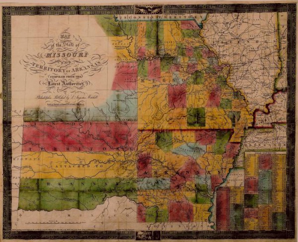
1835 map of the State of Missouri and the Territory of Arkansas
The map was made from the plates of the 1826 Finley map. Mitchell purchased Finley’s engraving plates around 1830 and then updated the map to reflect the growth. Note that modern day Oklahoma was then called “Indian Territory.”
The map is part of the Yeatman collection at Old Independence Regional Museum.